The World We Built on Wern Fawr Road
I wrote the first version of this for an ancestry site in 2008. What began as a few names and dates quickly turned into something else, a rambling journey back to the Swansea of my early childhood, with its half-forgotten faces, muddy adventures, and a world that has all but vanished.
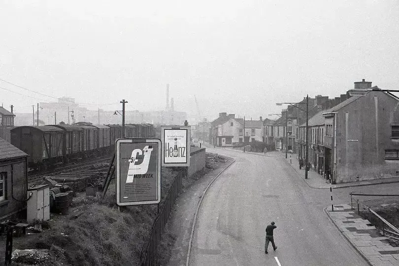
This is where it all began: Wern Fawr Road, Port Tennant, 1954 to 1962. These stories capture what it was like to grow up working-class in post-war Wales, when children had extraordinary freedom and parents had very little money. When one car between two streets meant you'd glimpsed wealth, and adventure meant disappearing into marshland for hours without anyone calling the police.
These aren't rose-tinted memories of a golden age. We were often cold, hungry, and occasionally up to things that would horrify modern parents. But there was something about that world, the tight community, the shared struggles, the way we created entire universes from scraps, which shaped us in ways I'm still understanding.
The Map of Our Kingdom
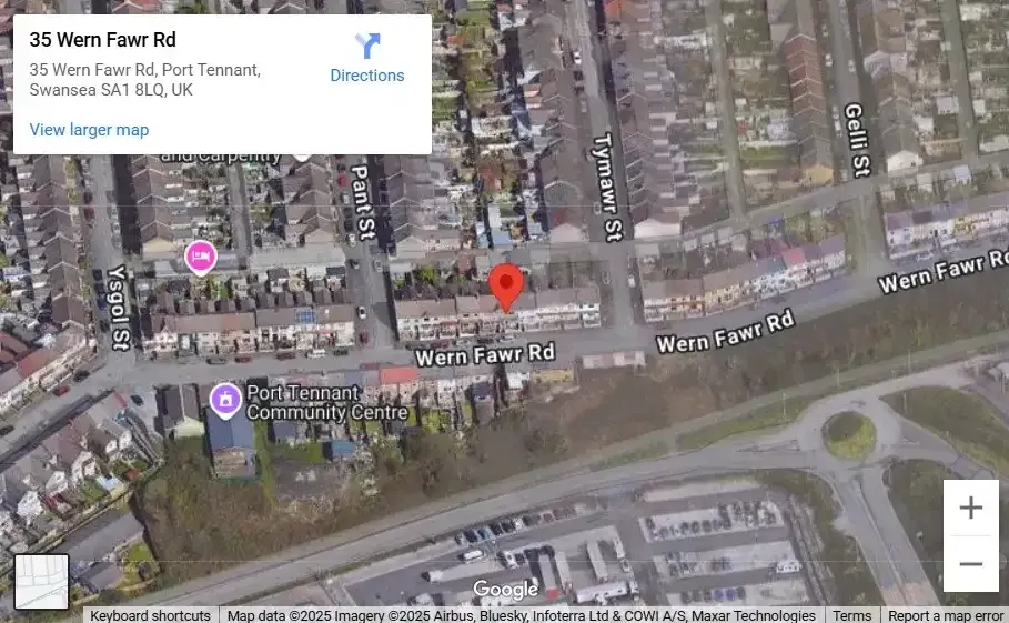
Our main area of daily “operations” was the area between Ysgol Street and Tymawr Street. We’d sometimes head as far as Gelli Street, and Kilvey Hill (behind the cemetery) was another frequent destination. During the long summer holidays, we’d roam much further afield, often up to no good.
At the heart of it all was The Bank, the area behind the houses opposite ours. It stretched along the railway lines to the right, and to the left as far as the Ebenezer Gospel Hall and down the backs of the houses on Ysgol Street. The land between The Bank and Fabian Way was a mix of railway tracks and marshy bog-land, perfect for getting mucky or disappearing into for a few hours. We were convinced one particular spot was a bottomless mud hole, a place where countless kids had vanished without a trace.
The World We've Lost
Looking at Google maps, the sheer number of cars is striking. In my day, there were hardly any. I think only Mr. Vincent, who lived next door, owned one. A car meant you were rich, or so it seemed to us. When we later moved to Blaenymaes, I was stunned by how many families had them. I thought we'd landed in a posh estate.
The street layout remains, but the world has been gentrified. The houses now have indoor toilets and central heating. The house numbers have changed. What was number 14 is now number 35.
And one thing's for sure, those tidy trees now planted around the neighbourhood wouldn't have lasted five minutes in our day. They'd have been chopped down by our parents for firewood, or by us kids for Guy Fawkes night bonfires.